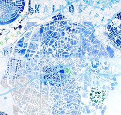
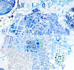
zoomandscale
In the context of the international symposium "Art and Cartography - Cartography and Art"
A Collaboration of Technical University Vienna, Academy of Fine Arts Vienna and RMIT University, Melbourne
"Art and Cartography - Cartography and Art"
Maps tell stories of the world. More precisely, they describe and represent the space surrounding us. As much as topographic surveys, maps also refer to the political, historic and social contexts of their time.
Jorge Luis Borges' "On Exactitude in Science" and Umberto Eco's "On the Impossibility of Drawing a Map of the Empire on a Scale of 1 to 1" describe the futility of creating a map of the world in the same scale - the attempt is proof that there is no such thing as a true map. And when we accept the fact that all maps necessarily omit or distort parts of reality, we can see that the gap between scientific and artistic cartography closes.
Whereas the scientific attempt to describe the world makes a normative claim by using rational systems like longitude and latitude, artistic methods use opposite approaches by challenging or ignoring these coordinates. Beyond rationalizing and measuring the space around us, artistic mappings tend to reflect their methods of representation and the conditions (in which they were made.). They may even take the liberty to shift points of reference to unexpected grounds. But even if artists seem to have more freedom, their strategies of interpreting maps are often very similar to those of cartographers.
Recognizing the discrepancy between maps and territories opens up room for interpretation and allows for different degrees of representational precision. In fact, artists' maps may capture issues which cartographers' "scientific" maps would never describe. This is what makes maps so intriguing: they communicate different views of our world and help us understand its complexity.
Is science bound to be objective and art subjective? The symposium "Art and Cartography - Cartography and Art" challenges these observations and stereotypes through its interdisciplinary approach.

© Wolfgang Fiel
"zoomandscale"
The exhibition features 14 international and local artists, architects and cartographers - as an integrated part of the conference. Their work will be shown in two locations, the aula of the Academy of Fine Arts and the lecture room of the Kunsthalle Wien's project space. The exhibition presents positions oscillating between art and cartography. These maps are reflections of individuals, or portraits of cities. Others raise the problem of how to describe places, or use maps as metaphors to create a vacuum of non-places.
The exhibition design was developed by the artists' collective collaborat.at (Johanna Reiner+Johannes Hoffmann) in cooperation with the architect, Antje Lehn. Paper banners divide the space. The white backdrop of paper serves as a projective backdrop for new views of the world. Tall ladders offer both a new perspective on the exhibit and an analytic overview, while binoculars play with distance and scale These everyday objects refer to the processes of cartography and invite the visitors to take part.

© Francous Gandon
Peter Dykhuis [CA]
"Pressure Today", Installation
Wolfgang Fiel [AT]
"Urban Adventures", Video
Gabu Heindl [AT]
"Following Maps", Installation
Christian Mayer [AT]
Tromso, 69.68°N, 19.58°W, 5/22/05, 00:00:00, Installation
Manuela Mourao [US]
"Whitewash", Painting
Nasrine Seraji, [FR/AT]
"Landmark Wales", Architecture project
Nicole Six & Paul Petritsch [AT]
"Ohne Titel", Drawings
Ludo Slagmolen [NL]
"Eridano", Painting
Laurene Vaughan [AU]
"The Map of Fashion" Object, Video
Ruth Watson [NZ]
"No Title", Installation, Drwaings
Opening Exhibit, free of charge
Friday 01.02.2008, 13.00-18.00 h
Saturday 02.02.2008, 13.00-21.00 h
Sunday 03.02.2008, 13.00-18.00 h
Friday, 01.02.2008
Kunsthalle Wien project space karlsplatz, Vortragssaal
18:00 h Presentation and Discussion
Exhibition (02.-03.02.08)
(reduced conference charge)
Presentation und Discussion:
Helen Chang / Stefan Gruber, Journalist/Architect
Wolfgang Fiel. Artist and architect
Maria Holter, Arthistorian
Giles Lane, Proboscis,
Christian Spanring
Titusz Tarnai / Wolfgang Tschapeller
Evamaria Trischak
Exhibition:
Helen Chang / Stefan Gruber, [AT]
"VIE_NY", Projektion
Theresa Häfele [AT]
"Community Karlsplatz", Projektion
Hosoya Schäfer Architects [CH]
"Maps", Projektion
http://www.hosoyaschaefer.com/
Giles Lane, probosics [UK]
"Social Tapestries", Installation
http://proboscis.org.uk
Sabine Müller-Funk [AT]
"This is not a map", Projektion
Waltraud Palme [AT]
"Piktogramme", Projektion
Christian Spanring [AT]
"Umbruch Aufbruch - Imangining Europe", Installation
http://spanring.eu/
Titusz Tarnai + Wolfgang Tschapeller + StudentInnen des IKA[AT]
"Performative Modelle" Modelle, Projektion
resolveuid/7d77d383e127ed21026392069c347559
Evamaria Trischak [AT]
"4816", Installation, Medienkunst
http://4816.nsew.at
Opening Exhibit Kunsthalle projectspace karlsplatz, free of charge
Saturday 02.02.2008, 16.00-24.00 h
Sunday 03.02.2008, 13.00-19.00 h
Credits | The exhibition "zoomandscale" is supported by:
Academy of fine Arts, Vienna, Institute for Art and Architecture
resolveuid/7d77d383e127ed21026392069c347559
Institute for Geoinformation and Cartography, Vienna University of Technology
http://cartography.tuwien.ac.at/
Mondial
http://www.mondial.at/
Pass'Partout
http://www.bilderrahmen.at
LENZING Papier
http://www.lenzing.com/papier/de
kub2 Ausstellungswände GmbH
http://www.kub2.at
Cultural Office of the City of Vienna, MA 7
http://www.wien.gv.at/kultur/abteilung/
City of Vienna, MA 48
http://www.wien.gv.at/ma48/
Special thanks to William Cartwright and Georg Gartner for starting "Art and Cartography" and to Andreas Spiegel for his encouragement and support.
List of entries
-
zoomandscale
In the context of the international symposium "Art and Cartography - Cartography and Art"
A Collaboration of Technical University Vienna, Academy of Fine Arts Vienna and RMIT University, Melbourne
Opening
Aula
Academy

